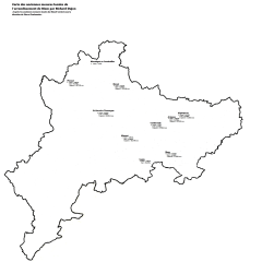
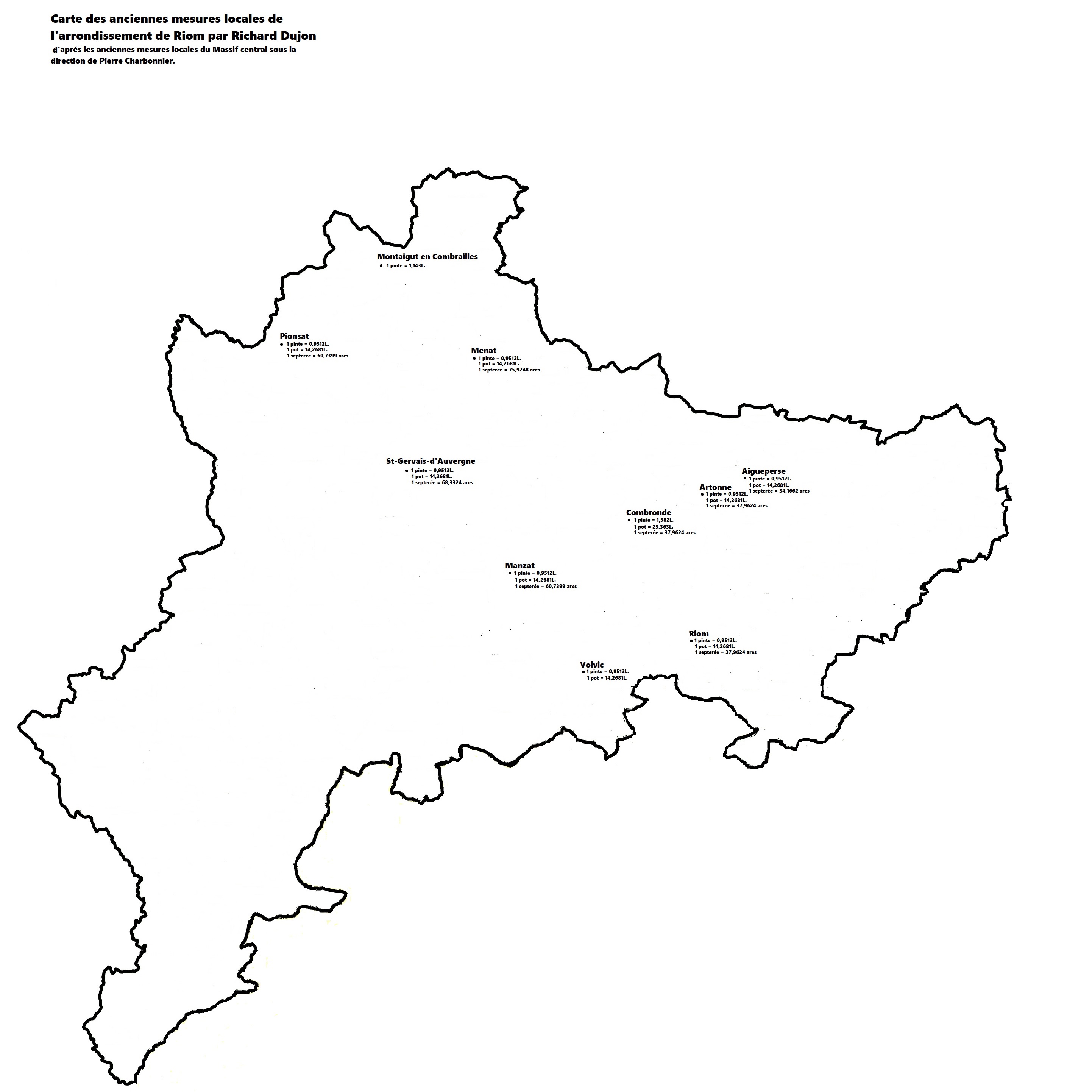
Map of the old measures of the district of Riom, by Richard Dujon, according to the old local measurements of the Massif Central under the direction of Pierre Charbonnier.
Mapa de las antiguas medidas locales del distrito de Riom por Richard Dujon,, según las antiguas medidas locales del Macizo Central bajo la dirección de Pierre Charbonnier.
Carte des anciennes mesures locales de l'arrondissement de Riom par Richard Dujon, d’après les anciennes mesures locales du massif Central sous la direction de Pierre Charbonnier.
Fichier principal
 carte des anciennes mesures locales de l'arrondissement de Riom par Richard Dujon.jpg (452.02 Ko)
Télécharger le fichier
carte des anciennes mesures locales de l'arrondissement de Riom par Richard Dujon.jpg (452.02 Ko)
Télécharger le fichier
Origine : Fichiers produits par l'(les) auteur(s)